

Isola Polvese Fortress

Photos
At a glance
- Region
- Umbria
- Province
- Perugia (PG)
- Town
- Castiglione del Lago
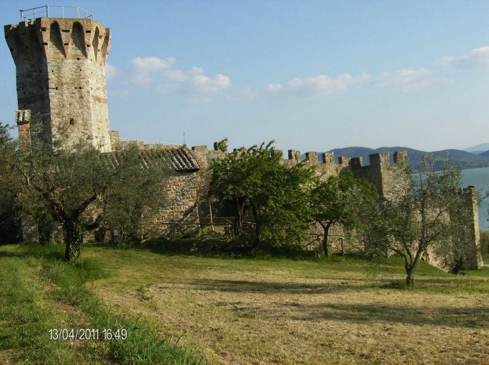
The fortress (rocca) of Isola Polvese is the medieval castle of the largest island of Lake Trasimeno (Umbria), today a scientific and educational park owned by the Province of Perugia.
History
The island
The island was occupied by the Romans; it is mentioned in 817 and in 1139 it placed itself under Perugia. From 1482 Olivetan monks lived there; in the 17th century the island declined and in 1643 troops of the Grand Duchy of Tuscany occupied it. In 1959 it was bought by Count Giannino Citterio and in 1973 it passed to the Province of Perugia; in 1995 it became a scientific and educational park.
Layout
The medieval castle (14th century) preserves its pentagonal curtain wall: it was not a true residence but an enclosure-fortress, a refuge for the islanders. The wall leans against the church of San Giuliano (11th century), with corner towers and an inner keep. On the island there are also the monastery of San Secondo (under renovation, not accessible) and the Porcinai swimming pool (1960).
Where it is
Isola Polvese (69.6 hectares) is a hamlet of Castiglione del Lago, in the province of Perugia; it is reached by the ferry service, in particular from San Feliciano.
Practical information
Tickets and where to buy them
Ferry tickets and any entrance fees: to be confirmed.
Opening days and hours
Ferry and island hours: to be confirmed.
Where to eat
Wikipedia reports a restaurant on the island, open mainly in summer: details to be confirmed.
Parking and services
Areas equipped for outdoor picnics and a small beach are reported on the island. Parking at the embarkation point: to be confirmed.
Accessibility and other information
Accessibility: to be confirmed. Information on educational activities and environmental tourism on the website of the body indicated by the sources (polvese.it).
Hours, prices and services often change: before your visit, call the official number or check the castle’s website. Last checked: November 2026.
How to get there
Directions with Google Maps Apple Maps
Hiking trails map (Waymarked Trails) Walking route
Trails: data © OpenStreetMap contributors (ODbL). Always check signs and trail conditions before setting off.

