Baglioni Castle
Photos




At a glance
- Region
- Lazio
- Province
- Viterbo (VT)
- Town
- Graffignano
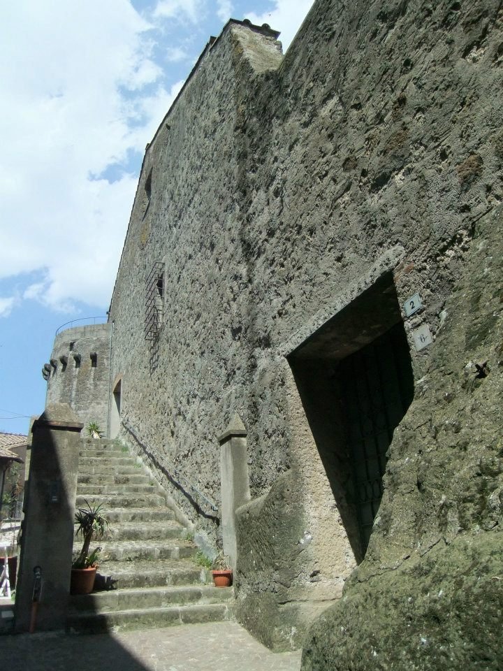
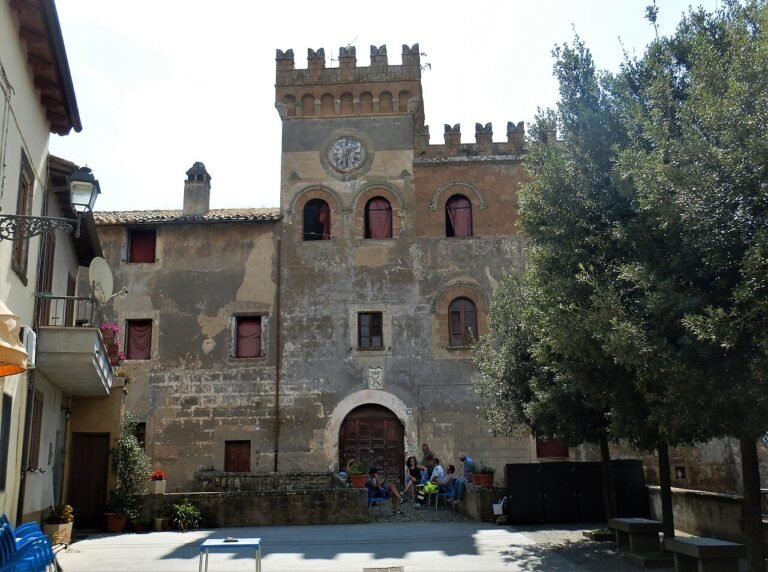
The Baglioni castle of Graffignano, in the province of Viterbo (Lazio), dominates the highest part of the village, in the Tuscia on the border with Umbria. The village developed around the fortress, so much so that the houses form a single body with it.
History of the Baglioni castle of Graffignano
A fortress defending the village
The sources describe a medieval fortress built to defend Graffignano from enemy attacks. The village has Etruscan-Roman origins but is documented only from the Middle Ages. On the dating of the castle the sources do not agree: they speak of the 13th century, of the 14th century (when the Baglioni are said to have had it built at the request of the Papal State, replacing an earlier residence) or of a proto-Renaissance building. The exact date is therefore to be confirmed.
Changes of ownership
The castle and the village changed hands several times, with disputes within the same family and between Viterbo and the Pope. The Baglioni held it until the 17th century, when it passed by inheritance to Domitilla Cesi Baglioni, a friend of Saint Philip Neri, whose cult and relics she brought to Graffignano. At the end of 1669 the property passed to the family of Federico Borromeo and later to the lord Scipione Publicola Santa Croce.
Saint Philip Neri in local tradition
The inhabitants turned to Saint Philip for the protection of the harvests; in dialect the expression “tocca espone san Filippo” survives, used when the season turns bad.
What to see
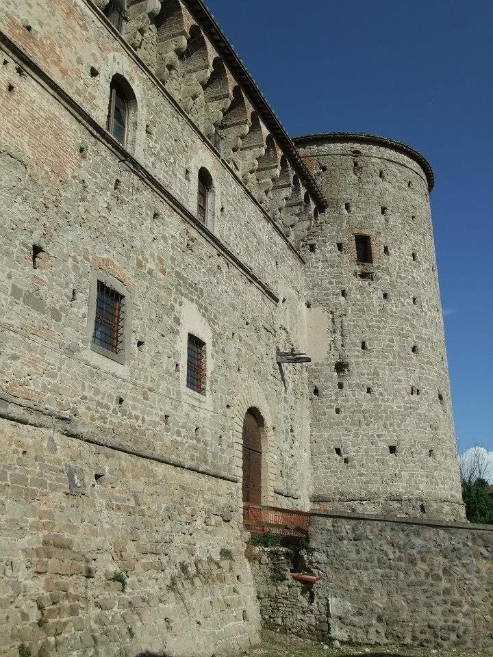
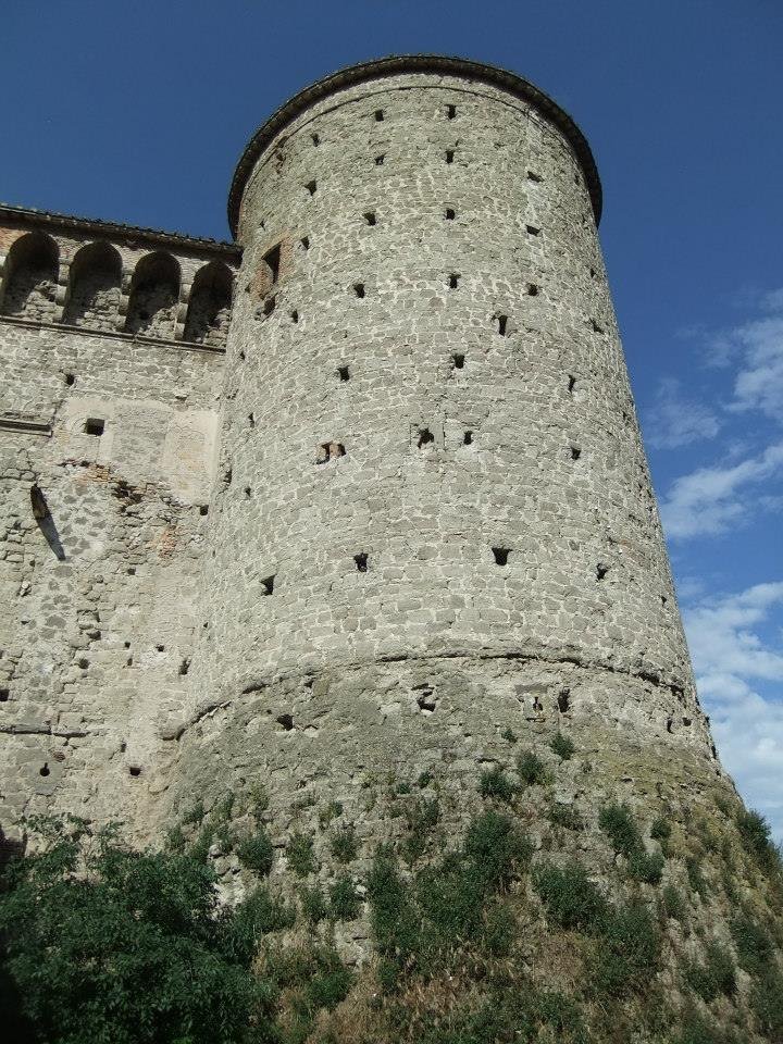
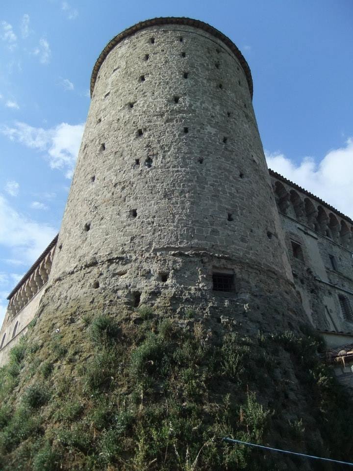
The castle has a rectangular main body and a large cylindrical tower, about 20 metres high according to one source and 23 according to another, with an internal spiral staircase. Around it you can make out houses with external staircases and cellars that once served as stables.
Where it is and how to get there
Graffignano stands at about 187 metres above sea level, in a panoramic position over the Tiber valley, among woods; it is about 20 km from Viterbo and, according to the sources, between 80 and 100 km from Rome. The castle is at the highest point of the village. The sources consulted give no directions by road or train: use an up-to-date map. The municipality borders Alviano, Attigliano, Bomarzo, Civitella d’Agliano, Lugnano in Teverina and Viterbo.
Practical information
Tickets and where to buy them
To be confirmed. Some pages give fares, but they perhaps refer to the castle of Sipicciano, a hamlet of Graffignano, and are not reliable for this building. Contact the Comune di Graffignano.
Opening days and hours
To be confirmed: one source says the castle is not open to visitors, another recommends visiting the interior without giving hours. Contact the municipality.
Where to eat
To be confirmed: the sources do not mention venues. Ask the municipality or the tourist office.
Parking and services
To be confirmed with the Comune di Graffignano.
Accessibility and other information
To be confirmed. The castle is in the highest part of a village on a crag, so climbs and stairs are likely; find out beforehand. The village is nonetheless pleasant to visit, strolling among the houses leaning against the fortress.
Frequently asked questions
Can the Baglioni castle of Graffignano be visited?
The sources disagree: one lists it as not open to the public. It is best to ask the Comune di Graffignano for confirmation.
Where is the Baglioni castle?
In the highest part of Graffignano, in the province of Viterbo, in Lazio.
Who were the Baglioni at Graffignano?
The family that held the castle until the 17th century, when it passed to Domitilla Cesi Baglioni.
In brief, the Baglioni castle of Graffignano (Viterbo) is the historic heart of the village and is worth a stop even just for the outside view.
Hours, prices and services change often: before your visit, call the official number or check the castle’s website. Last checked: November 2026.
Sources: VisitLazio, Roma.com, Discoverplaces, Wikipedia
How to get there
Directions with Google Maps Apple Maps
Hiking trails map (Waymarked Trails) Walking route
Trails: data © OpenStreetMap contributors (ODbL). Always check signs and trail conditions before setting off.
Foto: author not stated, published with permission